
Phase 1
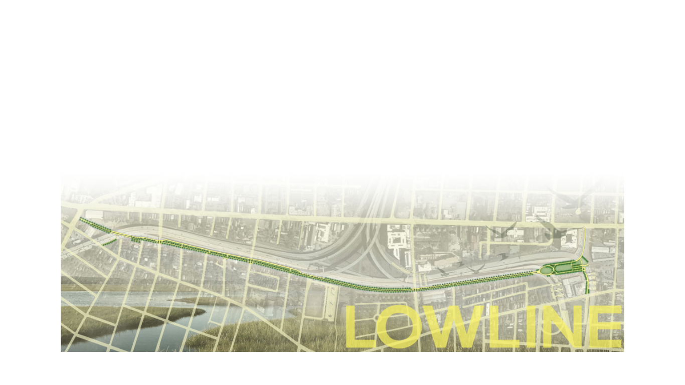
With a $16M investment from the City of Charleston and ground breaking scheduled for late 2025, the Lowline will become a reality; it’s first 1.6 mile will stretch from Mt. Pleasant Street to Line Street.
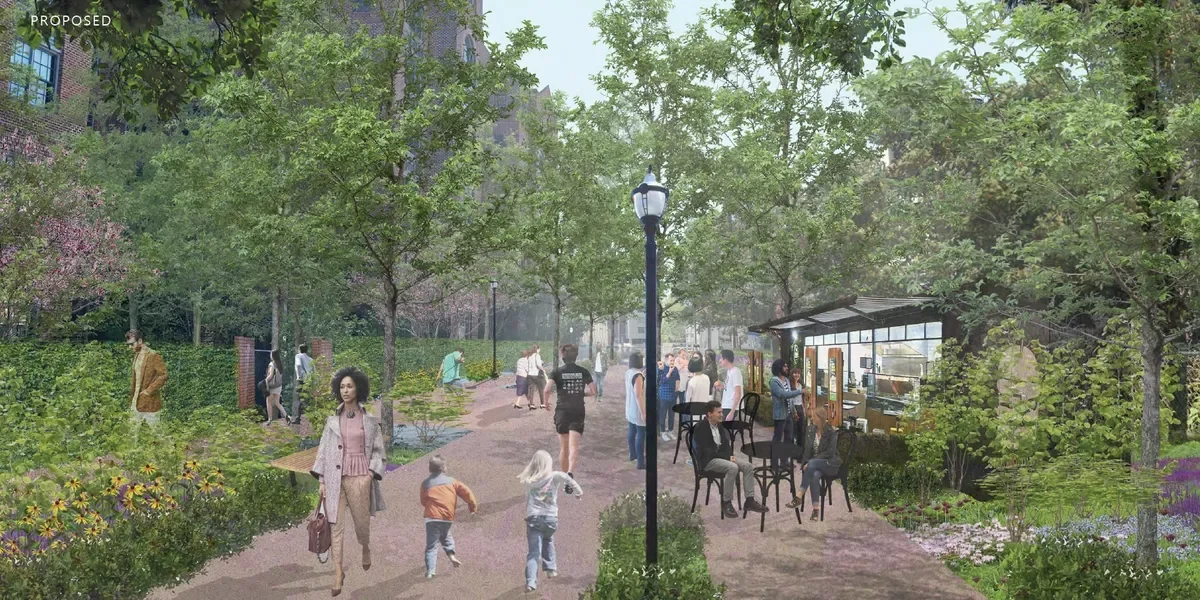
Two pathways; one pedestrian and one bicycle
Lowline Park; a central public space anchoring the southern end of the Lowline*
Park benches, lighting, restroom, and bike racks*
24-hour pedestrian-scale security cameras*
*Friends of the Lowline Funding Campaign Underway

Phase 1A is the central infrastructure that will lead the way for the three distinct districts of the Lowline.
North Central Corridor, Mt. Pleasant Street to Romney Street
The North Central Corridor runs from Romney Street to the planned transit hub on Mount Pleasant Street
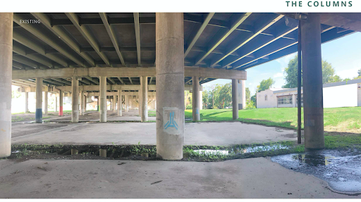
The North Central Corridor provides areas for active and passive recreation in "The Columns" beneath the elevated highway
"The Columns" area also provide ample space to host a neighborhood market
This district will include pocket parks where neighborhood streets end into the Lowline property
The potential transit oriented redevelopment of the Parks Department building provides an opportunity to create a new pedestrian district at the North end of the Lowline
The Parks, Romney Street to Spring Street
The Parks District runs from Romney Street to Line Street
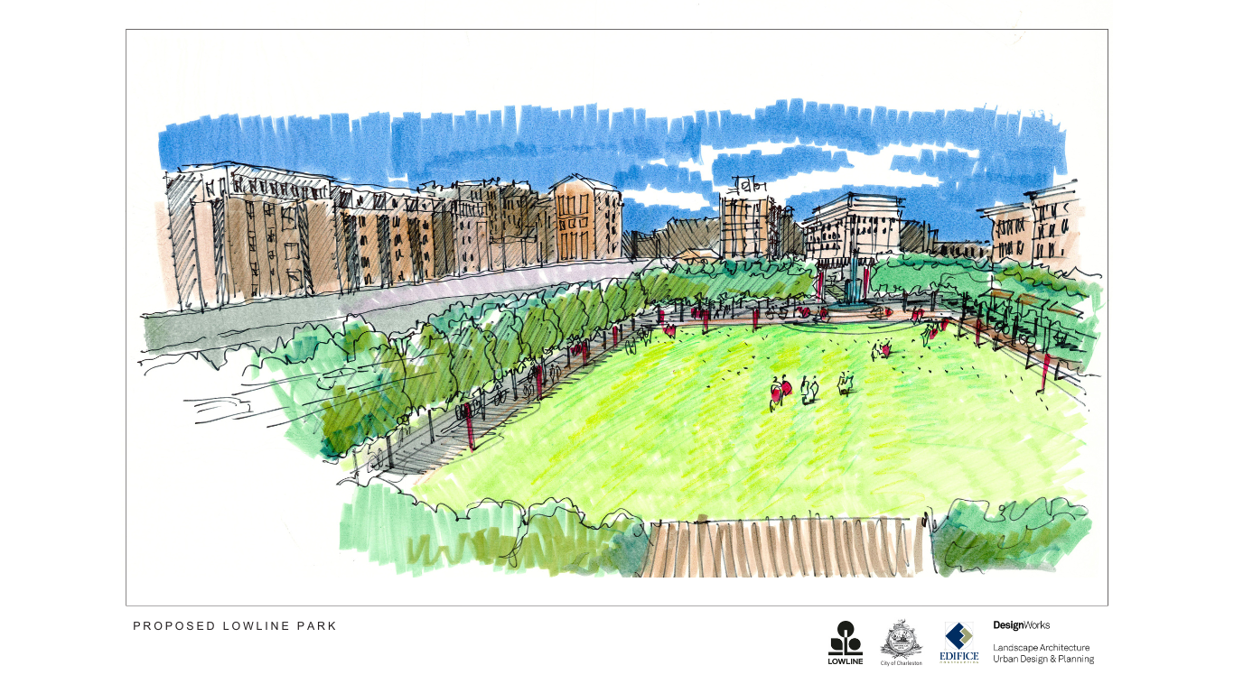
It is bookended by two new park spaces: New Market Creek Park to the North and Lowline Park to the South
Lowline Park is a large open space designed for events and gatherings
NewMarket Park is an enhanced Salt- and Fresh- water ecosystem
NewMarket Park provides a natural amenity for the public to enjoy while also enhancing stormwater management for the surrounding neighborhoods
Urban Core, Spring Street to Calhoun Street
The Urban Core District of the Lowline runs from Line Street to Marion Square
The District currently has the most diverse mix of uses and the highest density on the peninsula
The Lowline in the Urban Core is envisioned to be a series of alleys
Some portions of the Lowline already exist as alleys between Mary and Hutson Street
The side streets that connect King and Meeting streets will become important access points. Improvements to these connecting streets will be included in the Lowline
This Network of interconnected pedestrian walkways will enhance the entire district